Map & Navigation
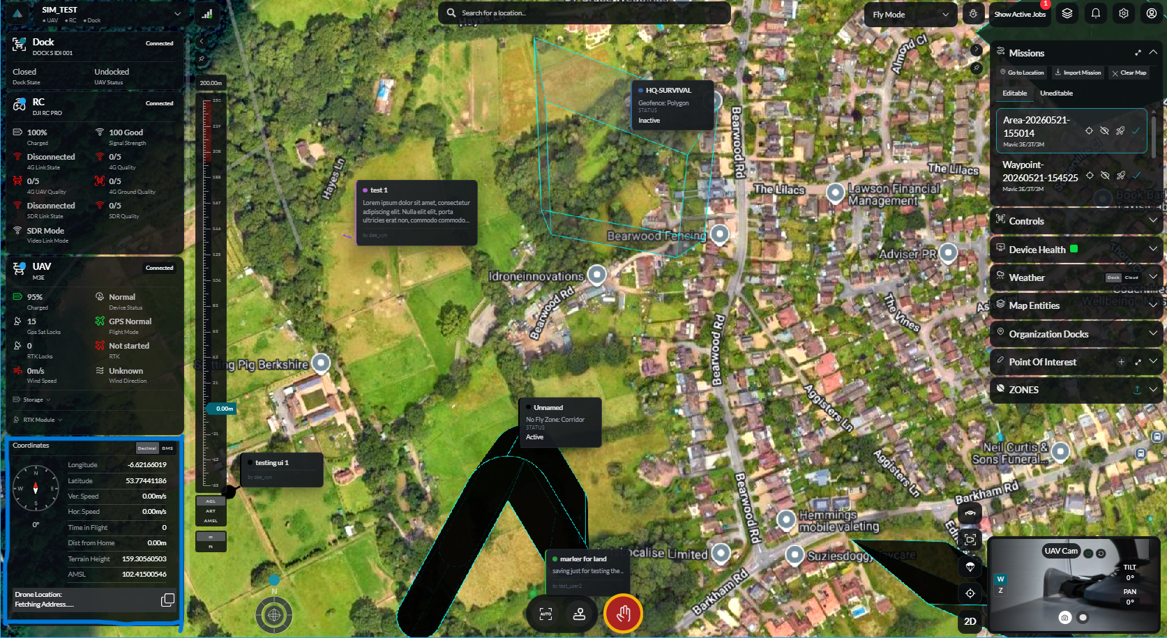
The IDI Fly Dashboard map is the central spatial interface for flight operations, mission design, and situational awareness. It is powered by Cesium and supports 2D and 3D views, multiple map layers, and a full suite of drawing and measurement tools.
In This Section
| Page | Description |
|---|---|
| Map Layers | Switch map styles, toggle 2D/3D, and manage asset overlays |
| Zones & Geofences | No-fly zones, custom geofences (circle and polygon) |
| Measurements | Distance, area, and volume measurement tools |
| Points of Interest | Create, view, and manage named POIs |
| Aircraft Tracking | Auto-follow drone, incursion markers |
| Annotations | Map annotation panel for adding contextual notes |
Map Controls
| Control | Action |
|---|---|
| Scroll wheel | Zoom in / out |
| Click + drag | Pan |
| Right-click + drag | Rotate |
M | Toggle map layers panel |
Esc | Close active tool or modal |