Fly Dashboard Overview
The Fly Dashboard is the primary workspace for monitoring and controlling drone operations. It combines mapping, flight controls, mission management, and operational tools into a single interface, allowing operators to manage missions without leaving the dashboard.
The dashboard is designed around an interactive map, with controls positioned around the edges of the screen for quick access during flight operations.
Top Panel
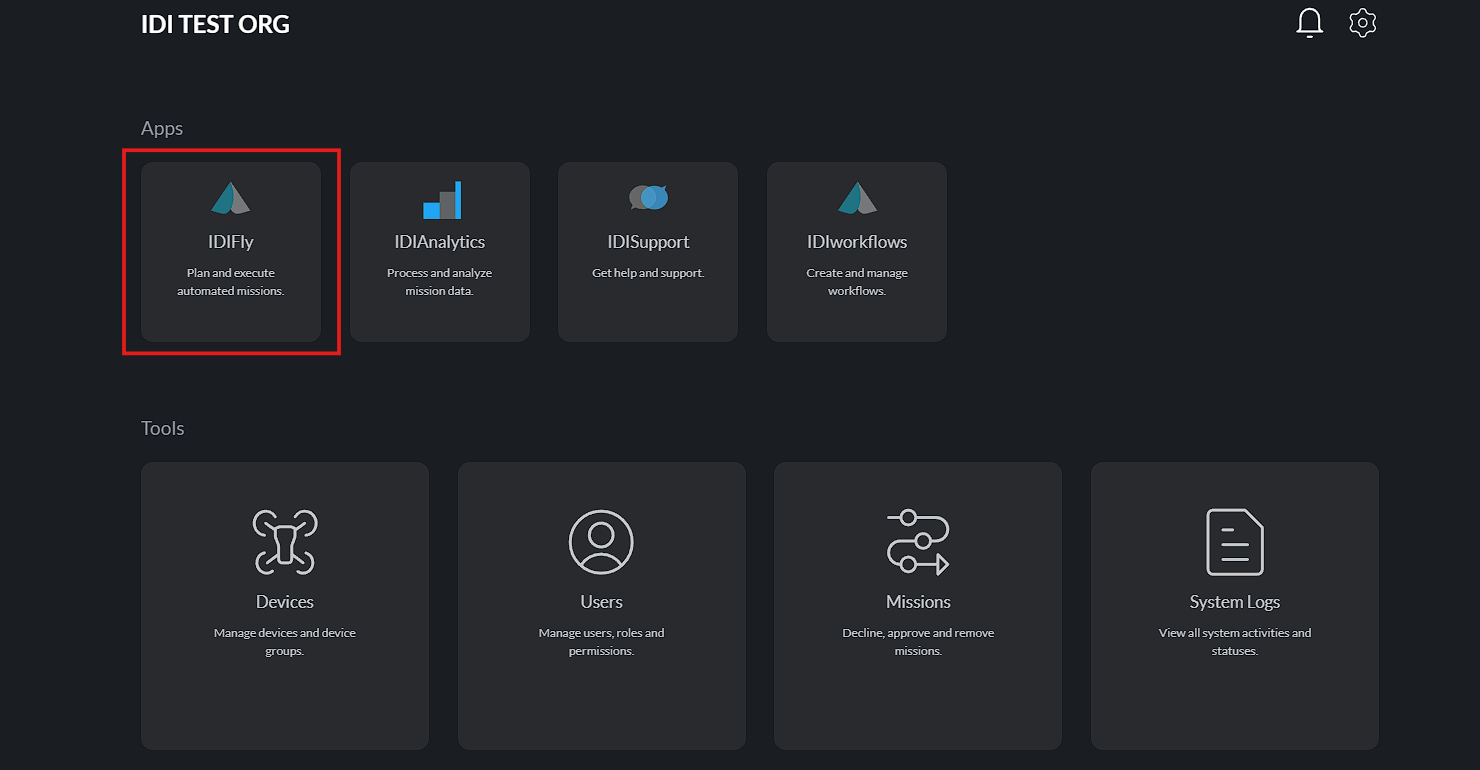
Back to Main Dashboard
Operators can return to the main platform dashboard at any time by selecting the back button.
Select Device Group
See Device Settings for detailed configuration.
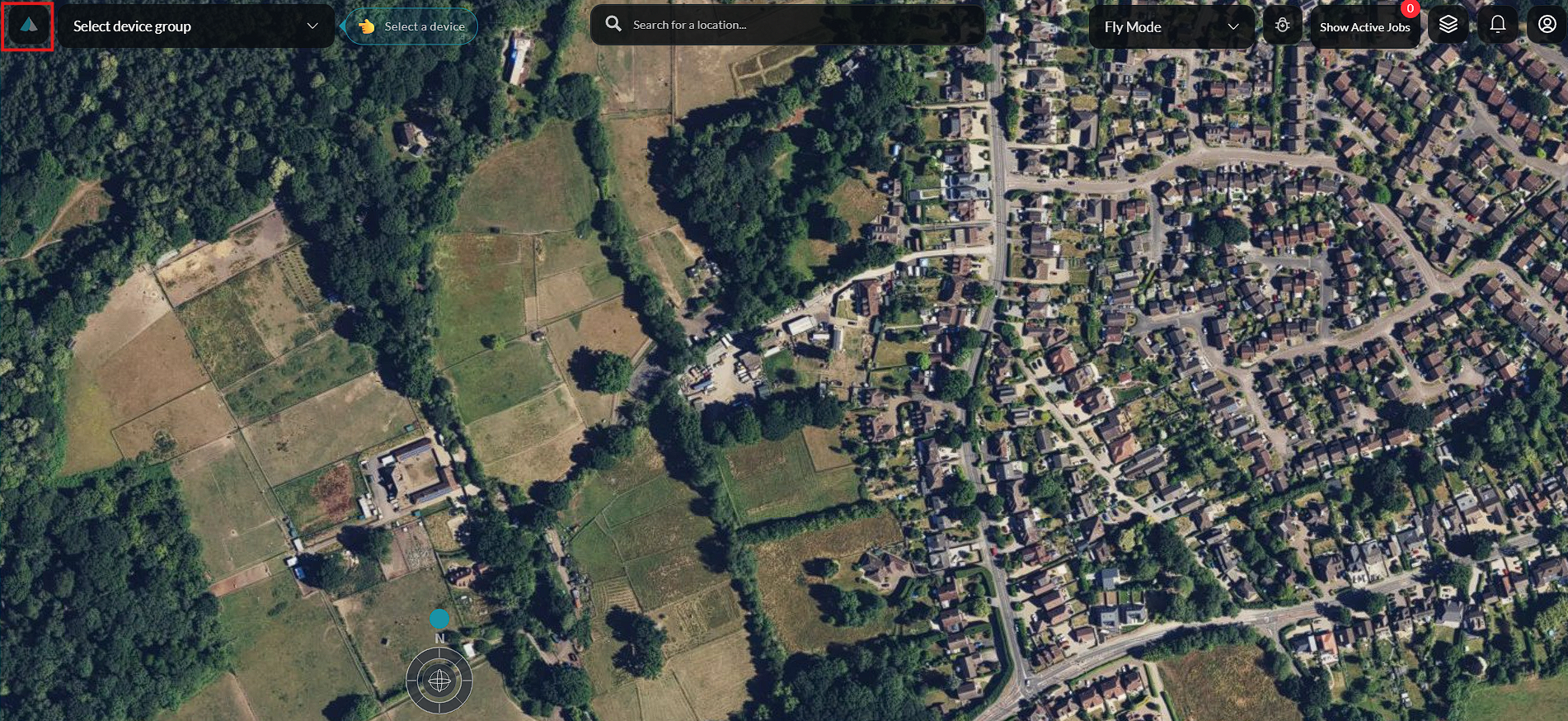
The Device Group selector displays the currently selected fleet or device group.
Selecting this control opens a list of available device groups, allowing the operator to quickly switch between different groups of drones and associated equipment.
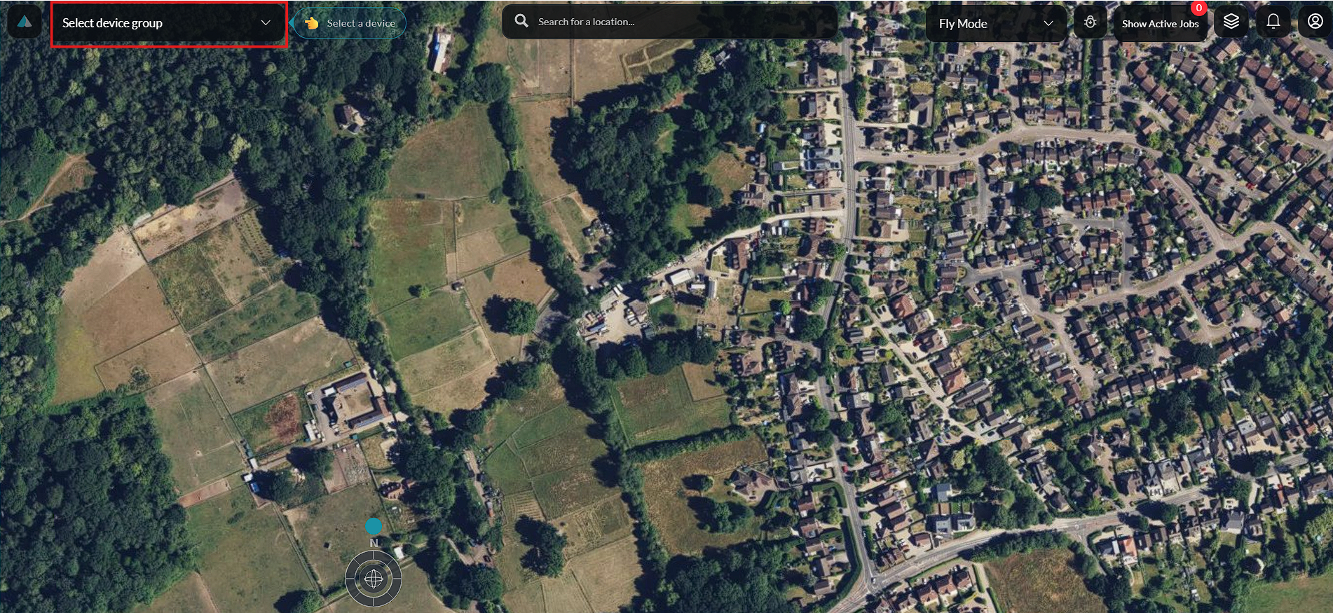
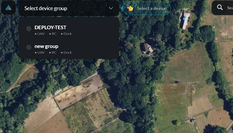
Once a device group is selected and a device is chosen, the dashboard updates to show the live telemetry and controls for that device.
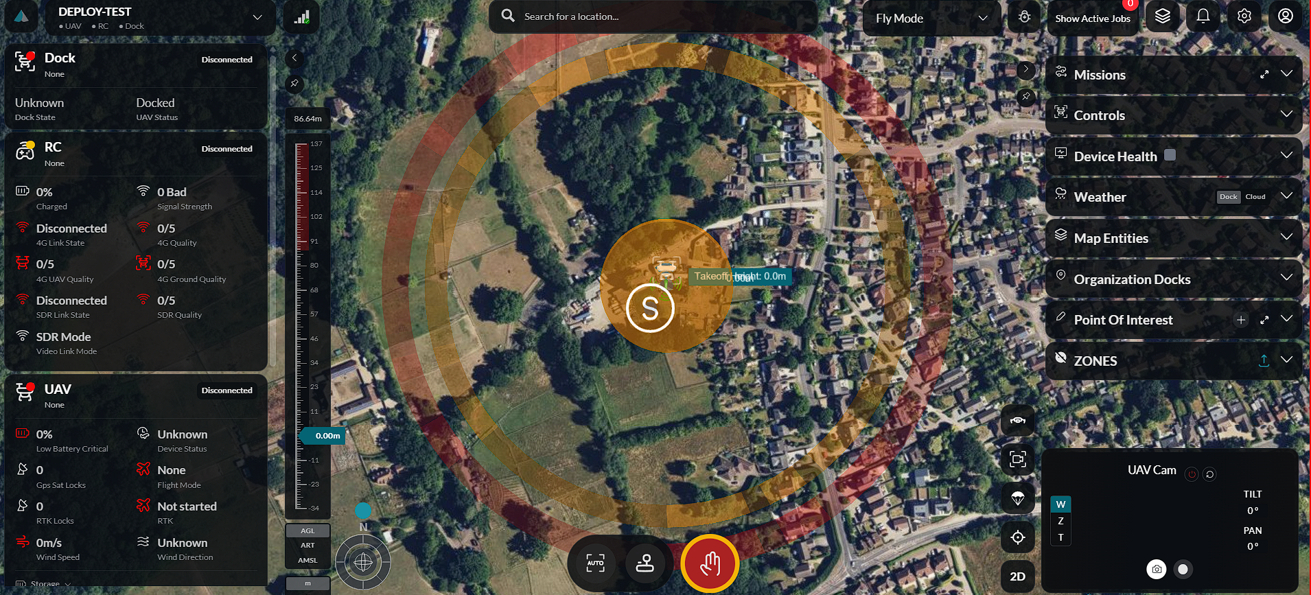
Search
The Search field allows users to locate a specific address, place, or set of coordinates.
As a location is entered, matching results are displayed. Selecting a result automatically centers the map on the chosen location, making it easier to prepare missions or navigate to an area of interest.
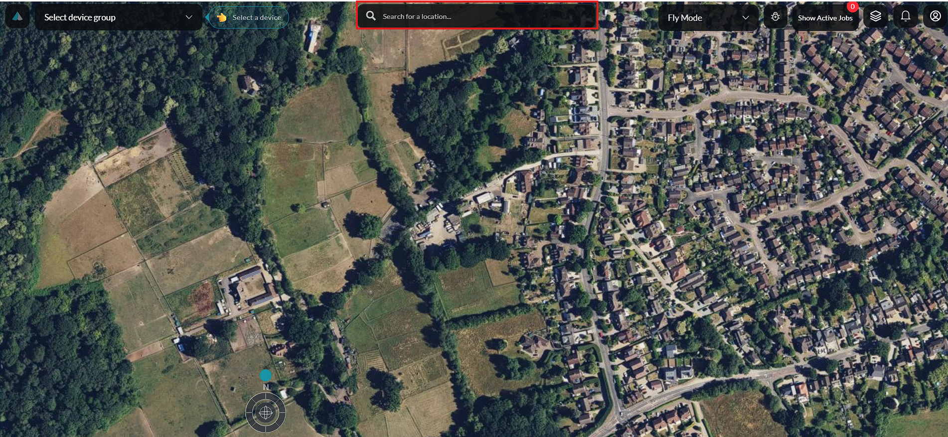
Fly Mode
See Mission Planning, Analytics, and Flight Story for detailed guides on each mode.
The Fly Mode selector allows the operator to switch between different operating modes available in the dashboard.
Selecting the dropdown displays the available modes — Fly mode, Planner mode, Analytics, and Flight story — allowing the operator to choose the most appropriate one for the current task.
- Fly mode — The primary workspace for real-time flight operations and live control.
- Planner mode — Used for creating, editing, and reviewing flight missions.
- Analytics — Provides access to flight statistics, device performance, and operational summaries.
- Flight story — Allows operators to replay and review historical flights.
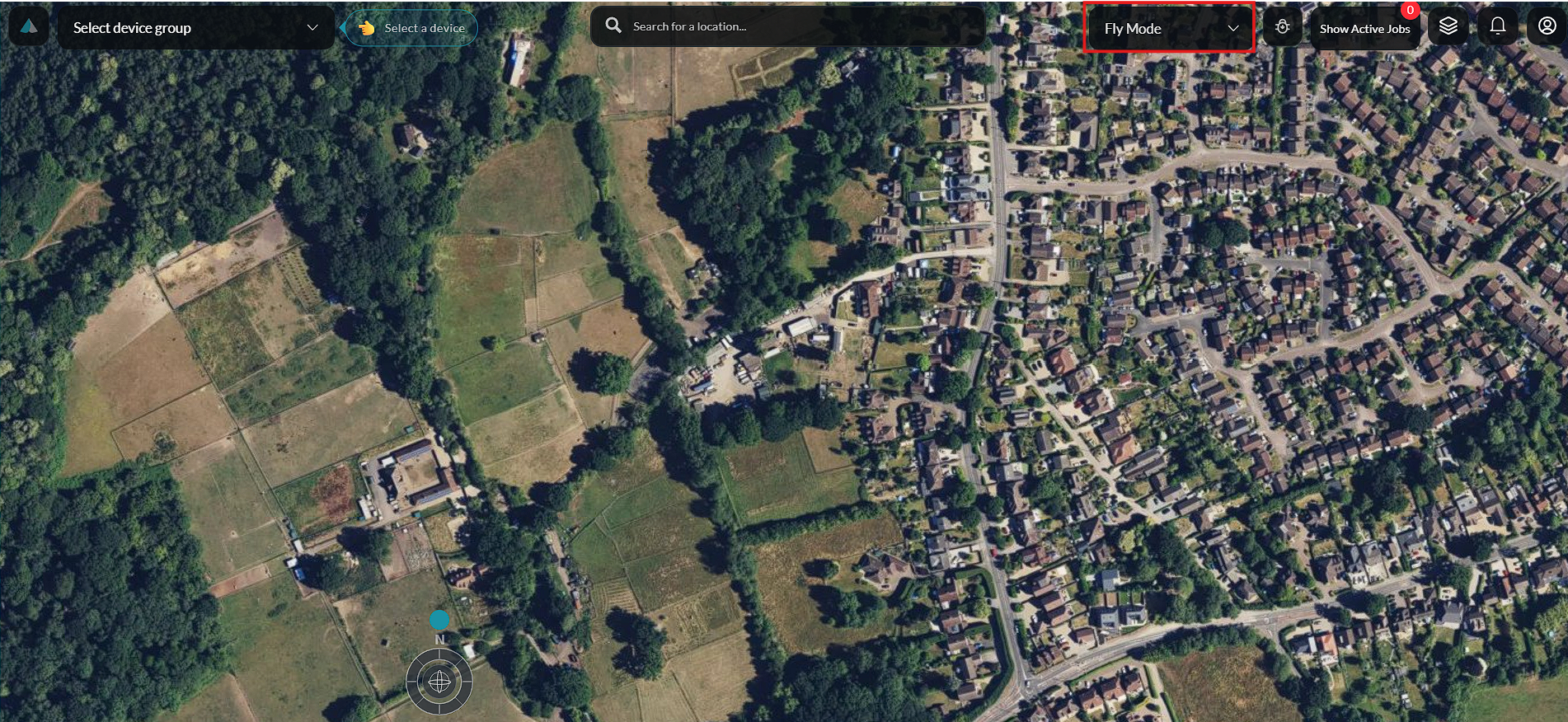
Debug
The Debug section provides access to system monitoring tools and bug reporting capabilities, allowing operators to report issues directly from the dashboard.
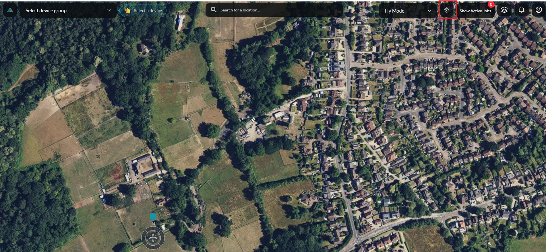
View Active
The View Active button displays all missions or background tasks currently running within the platform.
Selecting this option opens the active jobs panel, allowing operators to monitor ongoing activities and track their progress.
Map Layout
The Map Layout button controls the information displayed on the map.
Selecting this button allows different map layers and overlays to be enabled or disabled, helping users customise the map view for different operational needs.
Notification
The Notification button displays system alerts, mission updates, and operational messages.
See Notifications for more details.
A notification badge indicates when new notifications are available. Selecting the icon opens the notification panel, where messages can be reviewed.
Settings
The Settings button provides quick access to dashboard configuration options and operational preferences without leaving the Fly Dashboard.
See Settings for the full configuration reference.
Left Panel
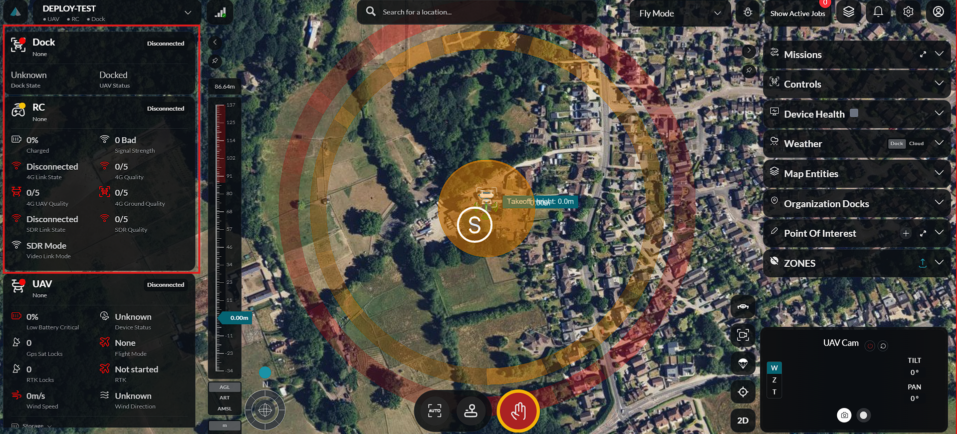
The Left Panel provides live operational information throughout the flight. It displays telemetry received from connected equipment and continuously updates as aircraft and controllers transmit new data.
The panel is organized into multiple telemetry sections, allowing operators to monitor the status of the dock, aircraft, and remote controller without obstructing the map workspace.
Dock Telemetry
See Deploy Device for dock deployment.
The Dock Telemetry section displays the operational status of the connected dock.
Information displayed may include:
- Dock connection status
- Dock health
- Charging status
- Environmental conditions
- Operational state
This information allows operators to verify that the dock is functioning correctly before and during flight operations.
UAV Telemetry
See Device Settings for detailed aircraft configuration.
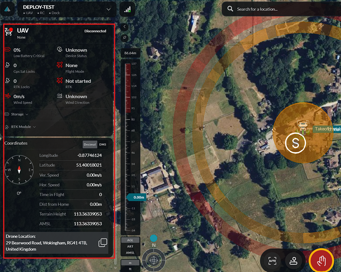
The UAV Telemetry section displays live information from the connected aircraft.
Telemetry includes key flight information such as:
- Aircraft status
- GPS status
- Battery level
- Flight mode
- Speed
- Heading
- Signal strength
Values update continuously while the aircraft is connected.
RC Telemetry
The RC Telemetry section displays the status of the connected remote controller.
Information includes:
- Connection status
- Battery level
- Signal quality
- Controller state
This enables operators to monitor controller health throughout the mission.
Altitude Meter
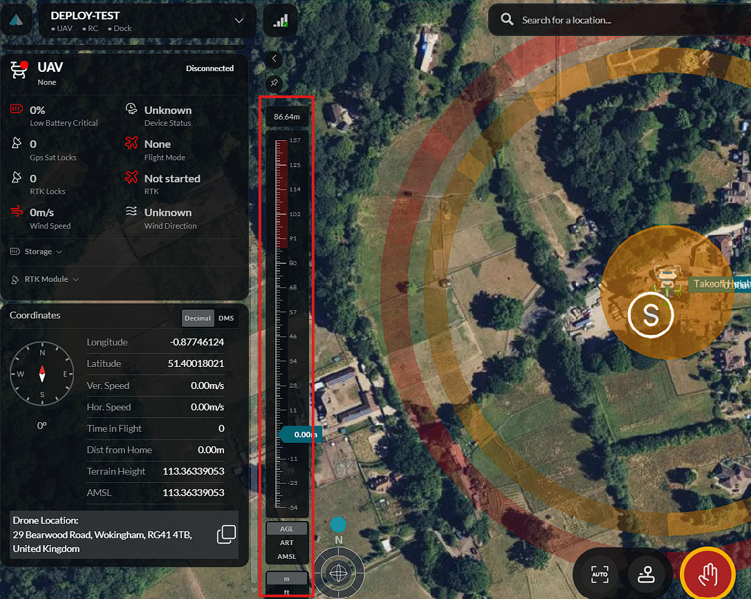
The Altitude Meter provides a graphical representation of the aircraft's current altitude.
The indicator updates in real time as the aircraft climbs or descends, allowing operators to monitor altitude at a glance.
Center Workspace
The Center Workspace forms the central area of the Fly Dashboard and is the primary view used during flight operations.
Interactive Map
See Map for detailed map features.
An interactive map displays mission locations, connected aircraft, operational overlays, and other geographic information in real time.
The map supports standard navigation controls, allowing users to:
- Zoom in and out.
- Pan across the map.
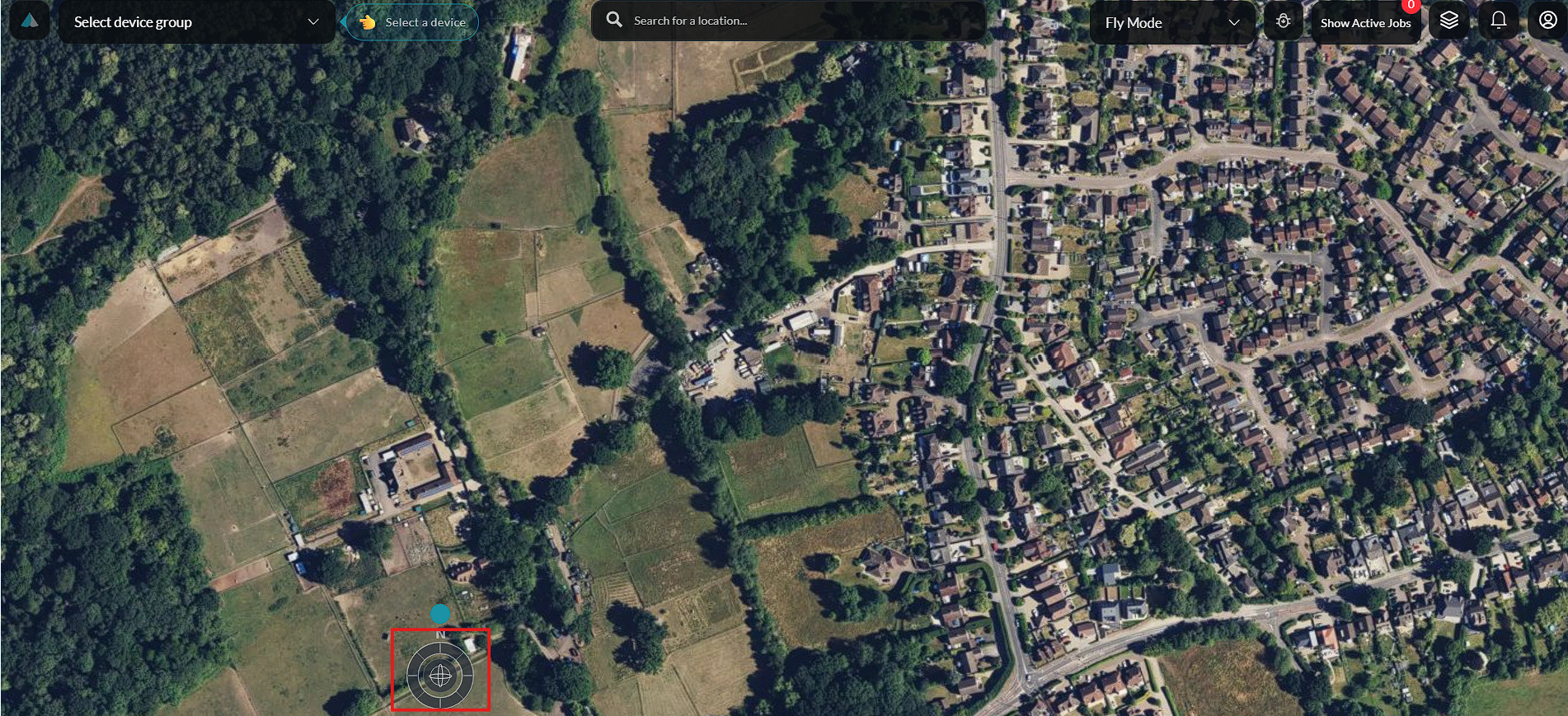
- Re-center the map on the current area of interest.
- Navigate freely to inspect surrounding locations.
Connected aircraft are displayed on the map using position markers. As an aircraft moves, its location is updated in real time, providing a live representation of its current position.
Mission-related information is visualized directly on the map, including flight paths, waypoints, take-off and landing locations, mission boundaries, and operational zones.
The workspace supports multiple map layers that can be enabled or disabled, such as satellite imagery, street maps, terrain, or operational overlays.
Navigation and Map Control
Map and Camera View Buttons
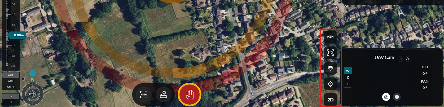
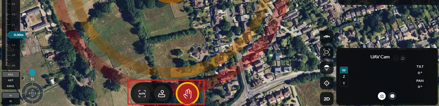
Drone Controls
Right Panel
The Right Panel provides access to the operational controls available within the Fly Dashboard. These controls allow operators to manage missions, connected devices, and map entities without leaving the main workspace.
The panel is organized into expandable sections, enabling users to focus on a specific operational task while keeping the interactive map visible.
Missions
See Mission Planning and Mission Launch for detailed guides.
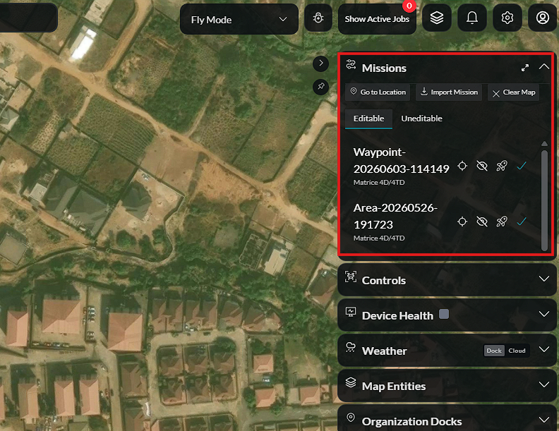
The Missions section contains the tools used to create, manage, and monitor flight missions.
From this section, users can:
- Create a new mission.
- View existing missions.
- Edit mission details.
- Monitor mission progress.
- Access mission-specific actions and information.
Selecting a mission updates the map to display its associated flight path, waypoints, and operational details.
Controls
See Manual Control and Camera Controls for detailed operation guides.
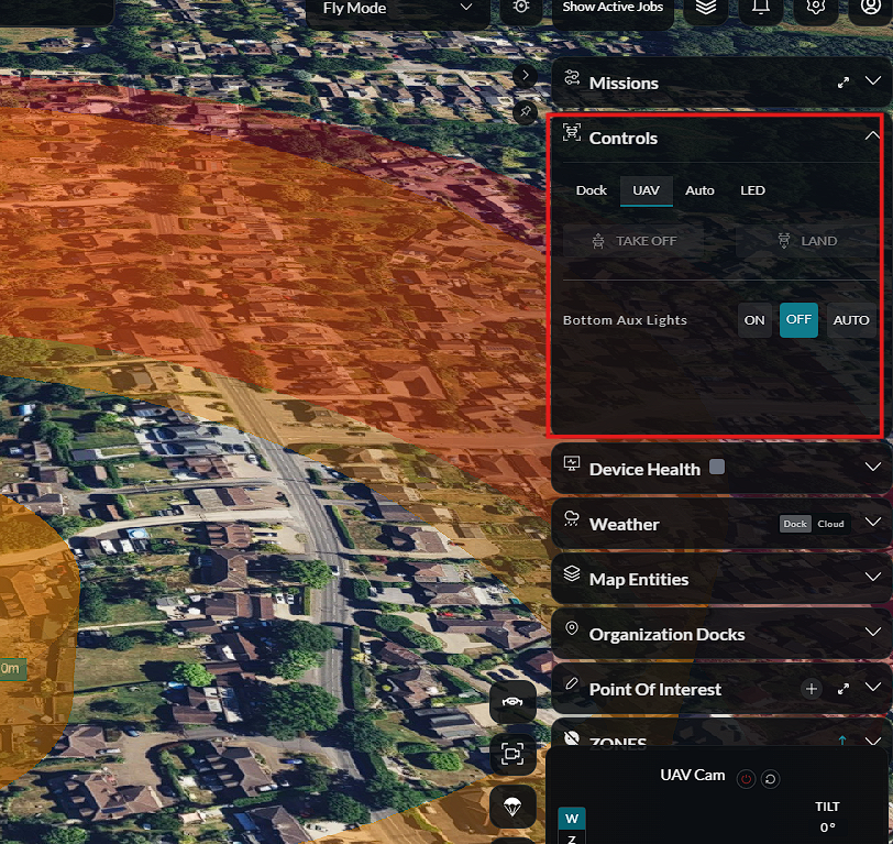
The Controls section displays the drones, docks, remote controllers, and other connected equipment available within the dashboard.
This section allows operators to:
- View connected devices.
- Monitor device status.
- Select a device for operation.
- Access device-specific controls and information.
Device control panels provide access to various subsystems:
- UAV Controls – Full flight control panel for the connected aircraft.
- Drone Controls – Aircraft-specific settings and commands.
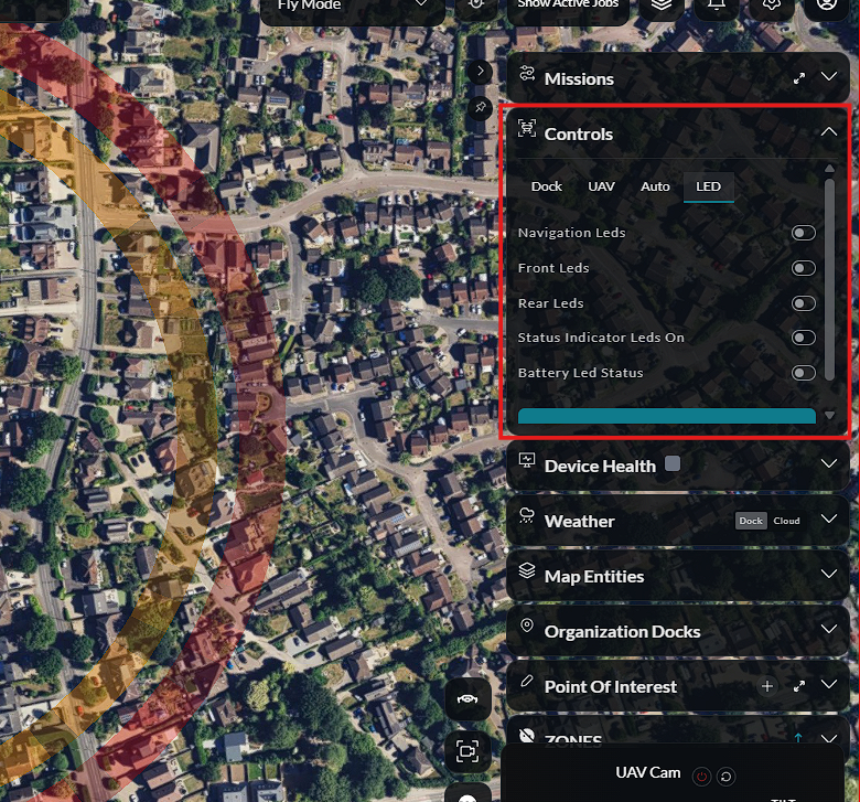
- Drone LED Controls – Manage aircraft lighting and visual indicators.
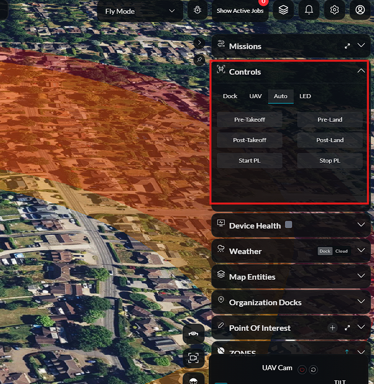
- Auto Controls – Automated flight control panel for mission execution.
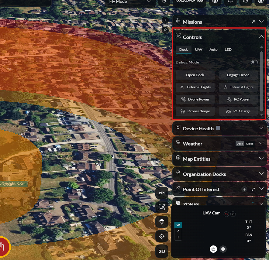
- Dock Controls – Manage dock cover, state, and camera views.
UAV Controls
Auto Controls
Drone LED Controls
Dock Controls
Device information is synchronized with the telemetry displayed on the left panel, providing a complete operational view.
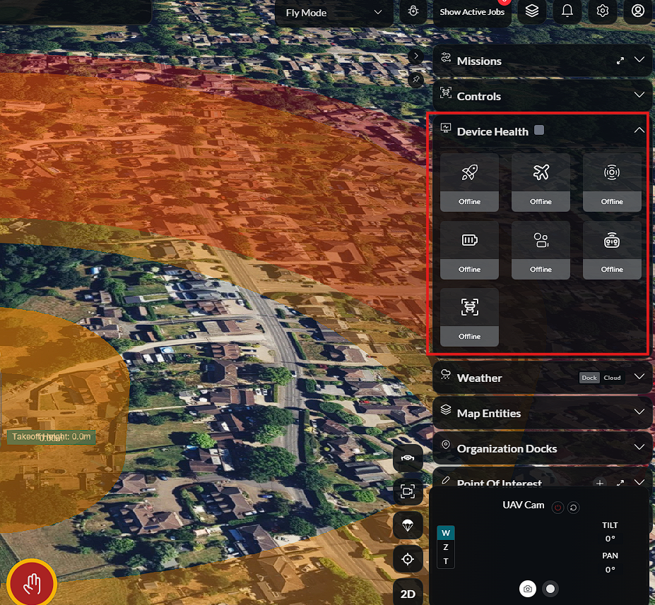
Device Health
The Device Health section displays the health status of all dock and aircraft systems.
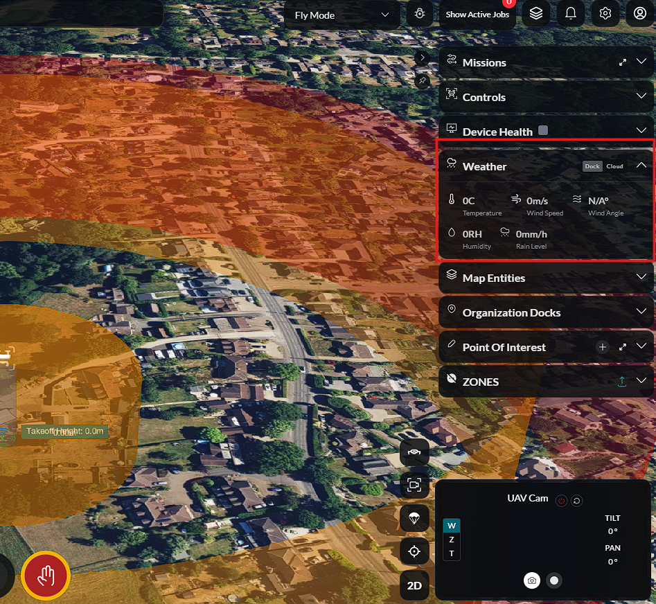
Weather
The Weather section displays current weather conditions at the mission location.
Information may include:
- Wind speed and direction
- Temperature
- Precipitation
- Visibility
- Weather alerts
This helps operators assess whether conditions are suitable for flight before and during operations.
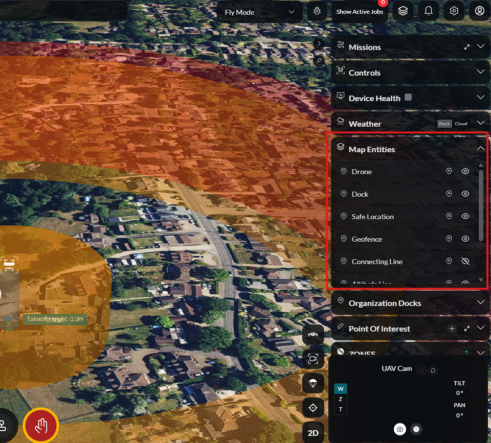
Map Entities
See Annotations and Points of Interest for detailed information.
The Map Entities section displays objects placed on the map such as waypoints, markers, annotations, and geofences. These entities provide additional context and operational reference points during mission planning and execution.
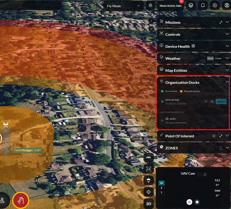
Organisation Docks
View and select from all docks available in your organisation.
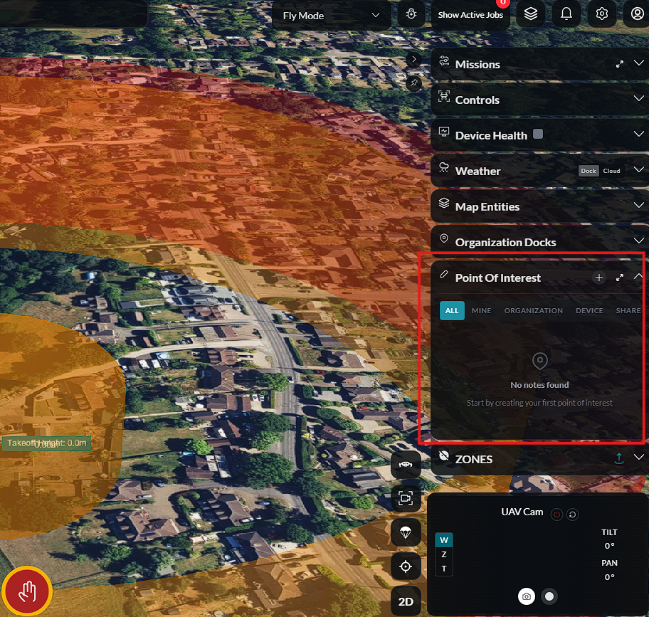
POI
See Points of Interest for detailed management.
Points of Interest (POI) are marked locations on the map that provide contextual information for mission planning and operations. Operators can view, add, and manage POIs directly from the dashboard.
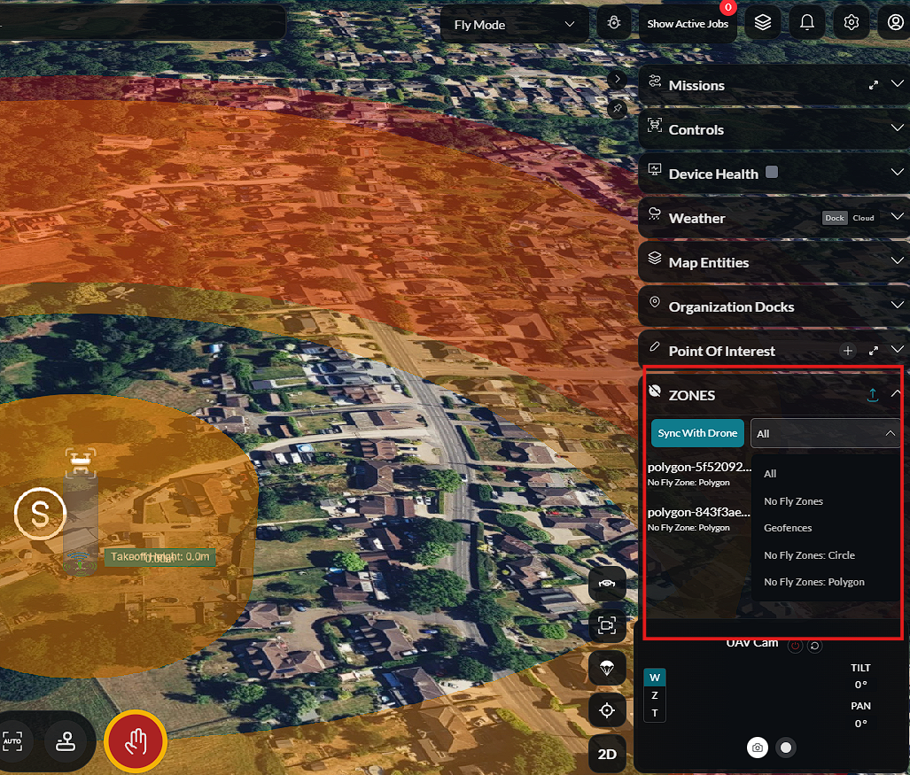
Zones
See Zones & Geofences for detailed configuration.
The Zones layer displays operational zones on the map, including no-fly zones, geofences, and other restricted areas. Operators can view zone boundaries and their associated rules directly on the map.
Bottom Panel
The Bottom Panel provides the primary operational controls used during flight. It combines live camera feeds, manual flight controls, emergency controls, and mission execution into a single workspace, allowing operators to monitor and control the aircraft without leaving the Fly Dashboard.
Camera View
See Camera Controls for detailed camera operation.
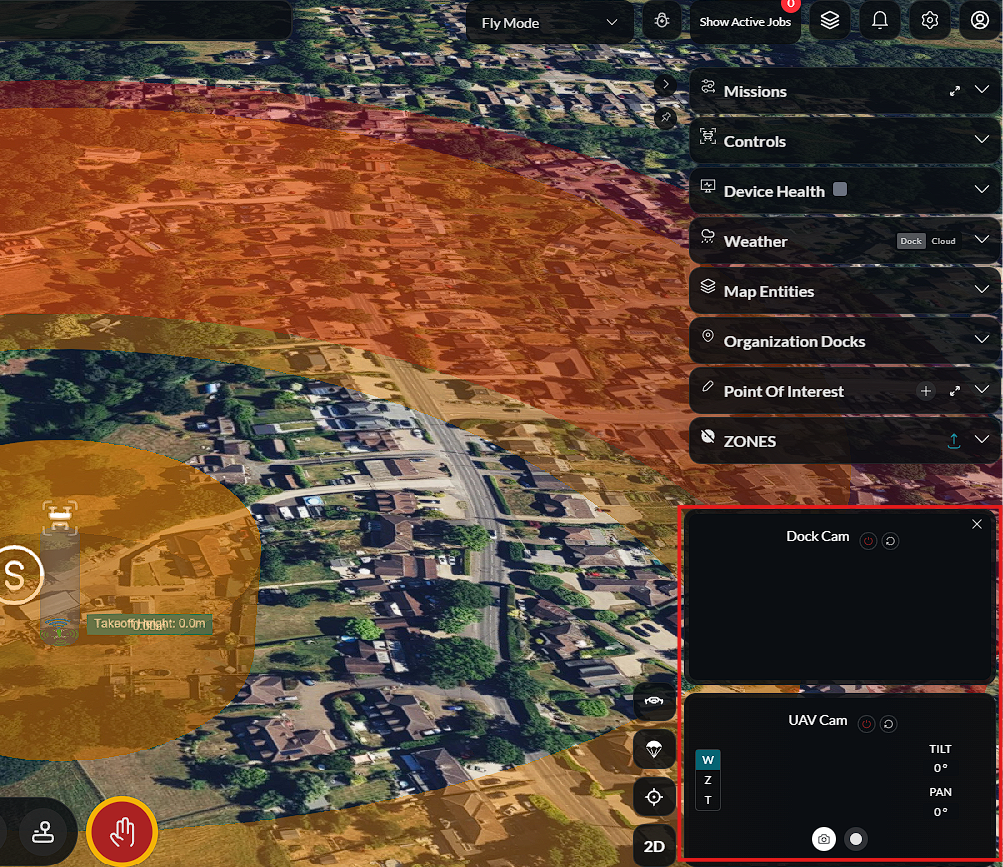
The Camera View displays live video feeds from connected cameras, providing real-time visual awareness throughout the mission.
Depending on the connected equipment, the dashboard can display:
- Dock Camera – Provides a live view from the dock, allowing operators to monitor the launch area and surrounding environment before, during, and after flight.
- UAV Camera – Displays the live video feed captured by the aircraft, enabling operators to observe the mission area from the drone's perspective.
The camera feeds update continuously while connected and support seamless switching between available video sources.
View and Camera Control
See Camera Controls for detailed camera operation.
Each camera feed includes controls for managing how video is displayed within the dashboard.
Available controls include:
- Show or hide the camera panel.
- Expand or collapse the camera view.
- Switch between available camera feeds.
- Resize or reposition the active camera view where supported.
These controls allow operators to optimize the workspace while maintaining visibility of critical flight information.
Emergency Stop
See Emergency Stop for detailed safety information.
The Emergency Stop button immediately stops the current aircraft operation when activated.
This control is intended for emergency situations requiring immediate intervention. Once activated, the aircraft responds according to its configured emergency behavior.
Warning: The Emergency Stop function should only be used when immediate action is required to protect personnel, equipment, or the surrounding environment.
Manual Controls
See Manual Control for the full manual flight guide.
The dashboard provides an on-screen Virtual Joystick for manual aircraft control.
The joystick enables operators to manually control aircraft movement, including:
- Forward and backward movement.
- Left and right movement.
- Vertical movement (altitude).
- Aircraft rotation (yaw).
Control inputs are transmitted to the aircraft in real time, allowing precise manual operation whenever manual flight is required.
Auto Sequence View
See Editable Mission for mission launch details.
The Auto Sequence View provides a step-by-step visualization of the automated mission.
Each task is displayed in the order it will be executed, allowing operators to monitor mission progress from take-off through landing.
As the aircraft completes each task, the sequence updates to indicate:
- Completed actions.
- The current active action.
- Remaining mission steps.
This provides a clear overview of the mission workflow while allowing operators to intervene if necessary.